Puerto Rico Day Trip

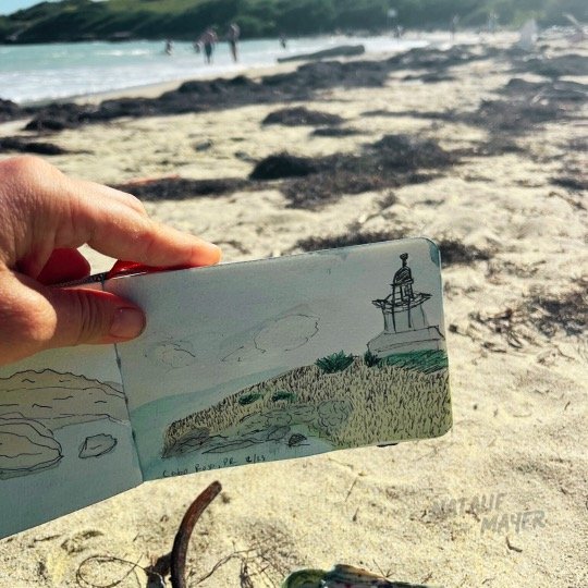
This month (February) with some new visitors in tow I made my second trip back to Cabo Rojo. Cabo Rojo is situated on the southwest corner of the island of Puerto Rico. Although it's considered rural it offers some great beaches, many outdoor experiences and great locally owned restaurants serving fresh seafood.
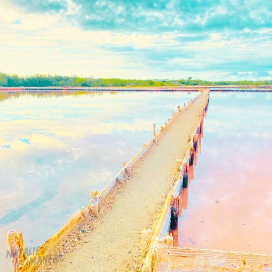
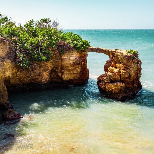
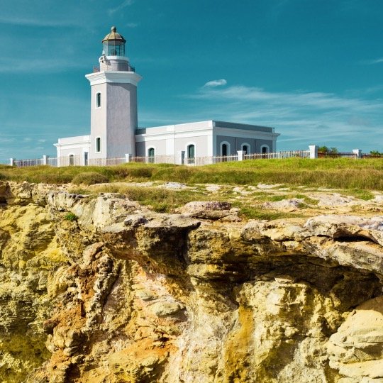
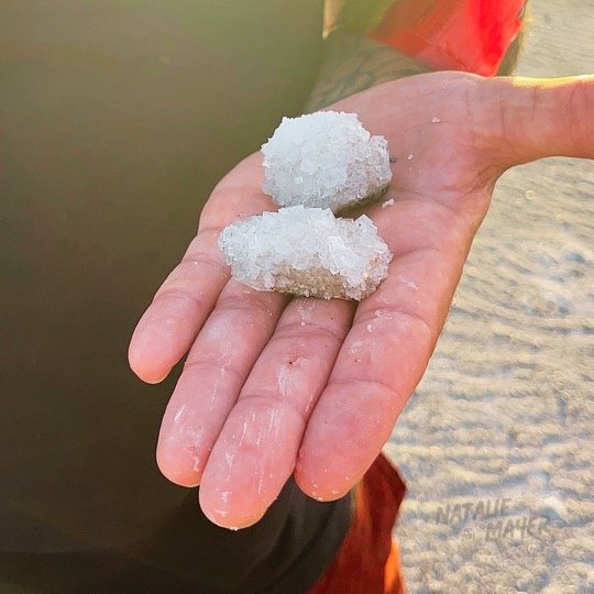
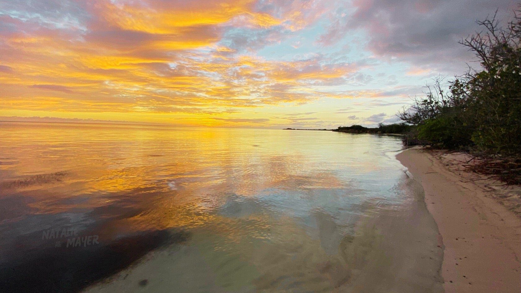
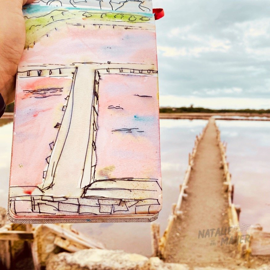
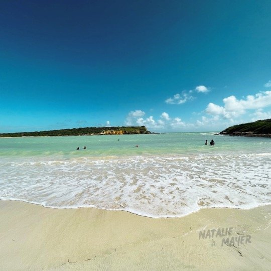
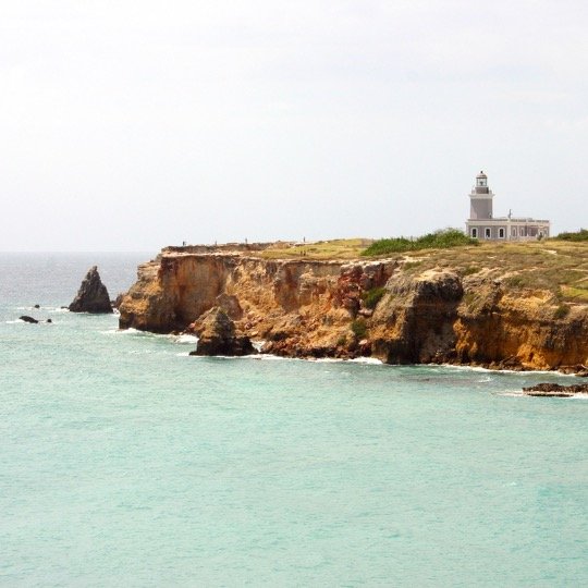
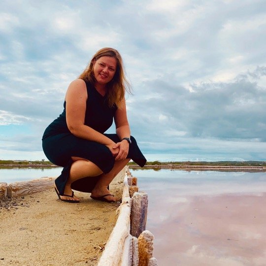
Cabo Rojo is home to arguably the most beautiful wildlife reserve in Puerto Rico. This reserve has become more well known by social media posting. Due to great photographic hotspots like the famous natural pink salt beds, a natural rock arch outcropping, a Spanish-colonial style picturesque lighthouse (first lit in 1882) perched atop stunting 360-degree views of the turquoise Caribbean sea and lastly near the lighthouse. A beautiful cove beach called La Playuela Sucia. A few hours on this beach in the almost white soft sand is like a dream – the water there is always warm, calm and beautiful.

Drive:
Now Getting to this area with all it has to offer is not as picturesque as social media makes it out. Its a long drive from most metorpitan areas. 2.5 hours each way from San Juan. Infact its the longest road trip you can take on the island before you start circling back round. Making it a pretty intense day trip. There are however many great vacation rentals in the region. Just make sure to check they have a/c and window screens in the summer. The heat and masquieos are no joke…
This beautiful island is the type of place you can stop and ask for directions. Even if you don’t speak spanish, download google translate and have fun. Most locals are friendly, neigbhorly and happy to share their stunning island with you. Just last week my motorcycle was having issues and I could not get into high gears. Which meant I was gonna have to drive it home at 15 miles an hour. Two older gentleman I had just interacted with in the grocer line came to my aid. Following behind me 3 miles out of their way. Insureing I made home safe without getting run off the road. This is the kinda place Puerto Rico is. But that said Google Maps is gonna be your best friend in Puerto Rico. Do not use apple apps or waze unless you like getting lost and driving off cliffs.
Directions: Google Map - “Faro Los Morrillos”.

This will map you to the lighthouse which is at the end of a penicela. So on route you’ll pass the unassuming pink salt flats on your left There’s no official parking since it’s not a designated tourist attraction but a working salt flat. There is also a nice nature lookout tower you can climb right before the salt flat entrance.
Unfortunately due to damage from hurricanes and lack of funding the reserve is not maintained. The road to the reserve will narrow and end at a gate. You’ll need to park on the side of the road and walk about 1.5 miles in. Its a salt flat aka swampy muggy and yet dry. Stagnant water does give off a potent smell and the mosquitoes are lively. However if you can bare this joint up the old road you’ll be richly rewarded. At the big fork in the road you can go right/straight to up to the lighthouse and cliffs or hang a left to the cove beach.
Tips: Gas up in Ponce on the way. Gas stations are far and few between off the main highway and they often close early or at randomly.
Pack:
Ice chest bag or something you can carry
Lots of water
Snacks
Sunscreen
Bug spray
Hat
Cash (Many rural stores and side of the road venders do not take Credit Cards)